I'll look at the interpretations for these charts (and others) later. For now, I just wanted to get them online.
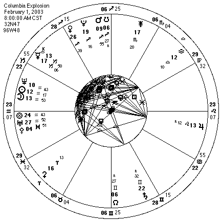
The preliminary data used in this chart may need revision later as better information becomes available.
The place used was Dallas, TX, based on analysis of the various amateur videos shown on network news coverage. I would most likely place it somewhat south of Dallas (in the direction of Waco), but the flight path was probably within 50 miles or so of this city. However, an object travelling at 12,500 miles per hour (about 20,000 kph) can easily travel 200 miles (320 km) in only one minute of time, about 3 or 4 degrees of longitude. Remember it was only a 16 minute ride from Texas to Florida, so take the longitude with a grain of salt. Due to the orbital path being flown, the uncertainty in the latitude is probably much less.
As an added quirk, this event wasn't on the earth's surface, but 207,000 feet up. I made no allowance for this in the chart.
The time used was based on data from the NASA briefing that afternoon. They cited the following timeline of events, rounded to the nearest minute of time. Central Standard Time (CST) was used for this timeline:
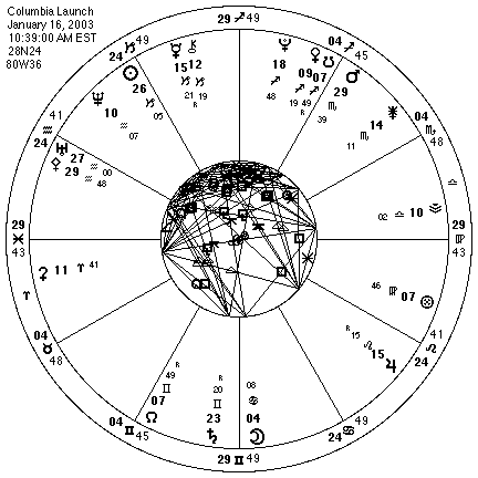
This launch time was taken from NASA's web site for the shuttle project.